

Conservation has always depended on information.
Where are animals moving? How many remain? Where is poaching occurring? Which habitats are being lost? Are populations recovering or declining? Answering these questions allows conservationists to decide where limited resources can have the greatest impact.
The difficulty is that modern conservation can now collect information on a scale that would have been almost unimaginable a few decades ago. Camera traps can produce millions of photographs. GPS collars generate continuous records of animal movements. Satellites repeatedly observe entire landscapes and oceans. Acoustic sensors can record thousands of hours of sound, while ranger patrols, aircraft and field researchers continually add observations of their own.
Collecting data is therefore increasingly only part of the challenge. The other is finding useful information within it.
Artificial intelligence, particularly machine learning and computer vision, is beginning to change this. AI can process enormous datasets, recognise patterns and flag unusual events far faster than a person could do manually. From identifying animals in camera-trap photographs to finding fishing vessels attempting to disappear from public tracking systems, these technologies are already being applied to real conservation problems.
But AI also has important limitations. Algorithms can make mistakes, inherit biases from their training data and overlook ecological observations that an experienced researcher might immediately recognise as significant.
The future of conservation is therefore unlikely to be AI replacing conservationists. Instead, its greatest potential lies in allowing conservationists to make better use of the extraordinary quantities of information they are already collecting.
The conservation data problem
Consider a network of camera traps.
A large survey can generate hundreds of thousands or even millions of images. Many may contain common species, livestock or no animal at all. Traditionally, researchers have had to manually inspect and classify these photographs before ecological analysis can begin.
The same problem exists with other technologies.
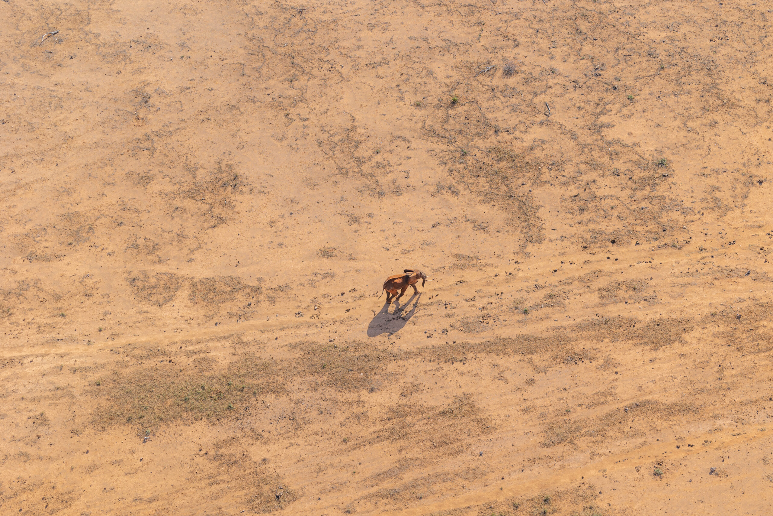
A GPS collar might provide thousands of locations for a single elephant. Multiply this across hundreds of animals and several years, then combine it with rainfall, vegetation, roads, settlements and human-wildlife conflict records, and the volume of information quickly becomes difficult to analyse manually.
AI is particularly useful because computers can perform repetitive classification and pattern-recognition tasks at enormous scale.
WWF, for example, uses the AI-powered Wildlife Insights platform to analyse camera-trap data. Its SpeciesNet model can automatically identify species within large collections of photographs, dramatically reducing the amount of manual sorting required before researchers can begin analysing wildlife populations.
This changes what is possible with conservation data. Instead of researchers spending much of their time sorting photographs, computers can conduct an initial classification and allow scientists to concentrate on interpreting the results.
Teaching computers to recognise wildlife
Computer vision can go considerably further than determining whether a photograph contains an elephant or zebra.
Many animals possess natural markings that are sufficiently distinctive to identify individuals. Zebra stripe patterns, giraffe coats and leopard rosettes can function much like fingerprints.
Computer vision can compare photographs against large databases and suggest matches, transforming photographs into long-term records of individual animals.
This is particularly useful for population ecology. If an individual is photographed repeatedly, researchers can begin establishing where it moves, how long it survives and which other animals it associates with. Across many individuals, these records can contribute to estimates of population size and survival.
The principle is similar to traditional capture-mark-recapture research, except the animal’s natural markings provide the identification.
For conservationists, this means photographs collected by researchers, camera traps and potentially members of the public can become ecological data rather than simply records of sightings.
From recording a threat to responding to it
Artificial intelligence can also change how quickly conservation information becomes useful.
Traditional camera traps have an obvious limitation for wildlife protection. A camera may photograph suspicious human activity today, but if its memory card is retrieved several weeks later, the photograph has little immediate operational value.
AI-enabled connected cameras can work differently.
A small computer can analyse photographs as they are taken, distinguish between different types of detections and transmit important images to conservation teams. Instead of sending every photograph, the system can prioritise those likely to require attention.
Tsavo Trust has previously examined the potential of this technology for anti-poaching. Combining camera traps with onboard computing, solar power and communications can allow relevant detections to reach rangers much closer to real time rather than waiting for cameras to be physically retrieved.
Similar technology is already operating elsewhere in Kenya. WWF reports that thermal camera systems equipped with automated detection capabilities are being used at 11 Kenyan rhino sites. The systems can distinguish movements involving people, wildlife or vehicles at night and alert operators in real time.
The important change is not simply better photography.
It is the transition from recording something that happened to providing information while conservation teams may still be able to respond.
Following elephants across Kenya
GPS tracking provides another example of how technology is changing conservation.
Kenya has been particularly important in the development of elephant-tracking systems. Save the Elephants has tracked elephants for decades, and its work contributed to the development of EarthRanger, a platform that brings information from wildlife collars, cameras, ranger observations and other sensors into one system.
Tracking an elephant’s location is useful by itself. Analysing its movement over time is considerably more powerful.
Long-term tracking can reveal migration routes and wildlife corridors. It can show where elephants repeatedly cross roads or leave protected areas. It can identify areas associated with crop raiding or other forms of human-elephant conflict.
Modern systems can also generate automated alerts. Geofences can notify conservation teams when a tracked animal crosses a particular boundary, while movement patterns can highlight locations where an animal has remained for an unusual period. EarthRanger is also developing increasingly configurable tools for identifying movement clusters and other patterns within tracking data.
Tsavo Trust already has much of the information needed for increasingly sophisticated analysis. In 2024, working with the Kenya Wildlife Service, Wildlife Research and Training Institute, Save the Elephants and Wildlife Works, 13 elephants were fitted with GPS collars. Tsavo Trust also uses EarthRanger to combine information from tracking, ranger operations and aerial patrols.
This creates the possibility of moving beyond simply asking where an elephant is.
Increasingly sophisticated analysis can investigate whether its movement is unusual, whether animals are repeatedly approaching conflict areas, whether movements change during drought or whether particular corridors are becoming more or less frequently used.
Can AI predict where poaching will occur?
AI is also being tested as a tool for deciding where rangers should patrol.
Protected areas can cover thousands of square kilometres, while ranger numbers and operational budgets are necessarily limited. It is impossible to patrol everywhere with equal intensity.
Systems such as PAWS, the Protection Assistant for Wildlife Security, approach this as a data problem.
PAWS analyses information including previous poaching observations, patrol records and landscape characteristics to estimate where illegal activity may be more likely. It can then produce risk maps and suggest patrol routes.
Field trials have demonstrated the potential of the approach. In Cambodia’s Srepok Wildlife Sanctuary, rangers following areas suggested by the system detected and removed 1,000 snares during the first month of field tests, alongside chainsaws, motorbikes and a truck associated with illegal activity.
The technology does not replace rangers. It helps decide where their time may be most effectively spent.
That distinction is important for Tsavo. The Tsavo Conservation Area covers an enormous landscape. Tsavo Trust has previously explored how predictive systems could eventually combine historical poaching incidents, terrain, water, vegetation, ranger observations and other information to produce dynamic risk maps. Such a system is not currently operating as a fully automated predictive patrol programme at Tsavo Trust, but existing tracking and operational datasets provide a foundation from which these tools could develop.
AI can watch an entire ocean
Perhaps one of the clearest demonstrations of AI’s ability to transform conservation comes not from wildlife on land, but from the world’s oceans.
Monitoring fishing activity presents a problem of extraordinary scale.
Many larger vessels broadcast their locations using the Automatic Identification System, or AIS. These signals provide valuable information about where vessels travel.
But they do not provide a complete picture.
Some vessels are not required to broadcast AIS. Others may not appear in public monitoring systems. Vessels can also deliberately stop transmitting, becoming part of what is often described as a dark fleet.
Global Fishing Watch has addressed this by combining vessel tracking with several different forms of satellite observation.
Synthetic Aperture Radar can detect vessels at night and through cloud. Optical satellites provide additional imagery. Nighttime sensors can detect the powerful lights used by some fishing fleets. Machine-learning systems can then process these different datasets and compare detected vessels against AIS records.
The scale illustrates why automation matters.
Global Fishing Watch’s processing of Sentinel-1 radar imagery produced approximately 20 million detections of vessels longer than about 10 metres. Machine-learning systems compared these detections against approximately 100 billion AIS position records, helping distinguish vessels publicly broadcasting their locations from vessels that were not.
No realistic team of analysts could manually compare that quantity of satellite imagery and vessel-position information.
AI can.

Finding fishing vessels that have gone dark
One investigation demonstrated what becomes possible when several datasets are combined.
Researchers examining waters around North Korea noticed that publicly available vessel-tracking information showed relatively little industrial fishing activity. Satellite observations suggested a different picture.
By combining AIS data with satellite radar, daytime optical imagery and nighttime imagery, researchers revealed a large fleet that had been largely invisible to conventional public monitoring.
The investigation identified more than 900 vessels of Chinese origin fishing in North Korean waters, in violation of United Nations sanctions. Estimates indicated that the vessels caught more than 160,000 tonnes of Pacific flying squid during 2017 and 2018.
Importantly, a vessel failing to broadcast AIS does not by itself prove illegal activity. Smaller vessels may not be required to carry the equipment, signals can fail and legitimate vessels can disappear from public tracking for other reasons.
The power comes from combining evidence.
Radar may show that a vessel physically exists. AIS can establish whether it is broadcasting. Optical imagery can provide another observation. Historical tracking can show where it came from, while machine learning can analyse movement patterns consistent with particular types of fishing.
AI does not determine guilt. It can identify activity that deserves closer investigation.
The same principle can be applied on land
The ocean example may seem far removed from elephant conservation in Tsavo, but the underlying problem is remarkably similar.
Conservation organisations increasingly possess multiple datasets describing the same landscape.
GPS collars show animal movements.
Camera traps record wildlife and people.
Satellite imagery records changes in vegetation, water and infrastructure.
Aircraft collect observations across enormous areas.
Ranger patrols record carcasses, snares, illegal camps and other incidents.
Rainfall and remote-sensing datasets describe environmental conditions.
Historically, much of this information has been analysed separately. Modern data platforms increasingly allow it to be brought together.
The next step is using computational tools to search across those datasets simultaneously.
For Tsavo, elephant movements could potentially be analysed alongside rainfall, vegetation condition, water availability, previous conflict locations and human activity. A change that appears insignificant in one dataset may become important when several sources of information are considered together.
This is where AI’s ability to find relationships within large and complex datasets could become particularly useful.
Listening to an ecosystem
Not all conservation data are visual.
Autonomous acoustic recorders can remain in an ecosystem for months, continuously recording the surrounding soundscape. The result can be thousands of hours of audio containing birds, insects, frogs, mammals, vehicles and human activity.
Listening to all of it manually is impractical.
Machine-learning systems can instead be trained to detect particular acoustic signatures. Depending on the ecosystem and equipment, these might include animal vocalisations or human-generated sounds such as vehicles, gunshots or chainsaws.
At a larger scale, ecoacoustics can help researchers investigate changes in biological communities through changes in their soundscapes.
Again, the fundamental contribution of AI is scale. A scientist still determines which questions matter and interprets the ecological meaning. The computer makes it possible to examine quantities of information that would otherwise remain largely unused.
Where AI can go wrong
The potential is considerable, but AI does not automatically produce better conservation.
Its usefulness depends on the quality of the data, the design of the system and, crucially, the people interpreting its output.
AI can be wrong
Computer-vision systems can misidentify animals. Predictive models can identify the wrong area as high risk. Tracking systems can interpret unusual movement incorrectly.
False positives matter.
A vessel disappearing from AIS is not necessarily fishing illegally. An elephant remaining in one place is not necessarily injured. A person detected by a camera inside a conservation landscape is not necessarily involved in illegal activity.
Automated detections should therefore be treated as evidence requiring interpretation rather than unquestionable conclusions.
AI inherits the limitations of its data
Machine-learning systems learn from the information used to train them.
If a wildlife-recognition model has thousands of clear daytime photographs of elephants but relatively few obscured nighttime photographs of a rare carnivore, its performance will not necessarily be equal for both.
Rare species create an obvious difficulty. The animals conservationists may most urgently want to identify can be precisely those for which the fewest training examples exist.
Similar problems affect predictive systems. Historical poaching records do not represent every place where poaching occurred. They represent places where illegal activity was detected.
Areas receiving more patrol effort may consequently generate more records, potentially introducing bias into the dataset.
AI may overlook what an ecologist notices
There is also a more subtle limitation.
Most AI systems are built or trained to identify particular species, behaviours, sounds or statistical patterns. This makes them extremely efficient at finding what they have been designed to find.
Scientific discovery, however, often begins with something nobody was specifically looking for.
An experienced ecologist examining camera-trap photographs might notice an unusual association between two species. A researcher looking at tracking data might recognise a subtle change in movement that does not fit the animal’s normal behaviour. A field biologist may notice an unexpected change in vegetation, breeding behaviour or habitat use that lies completely outside the original research question.
An automated system may simply classify the photograph correctly, record the GPS position or process the measurement and move on.
More advanced anomaly-detection systems can identify patterns that differ statistically from normal data, but statistical abnormality is not the same as ecological significance. Conversely, an ecologically important observation may not appear sufficiently unusual to trigger an algorithm.
There is therefore a risk that excessive dependence on automated analysis could make conservationists extremely efficient at finding what they already know to look for while overlooking what they did not know to look for.
Experienced ecologists provide something different: context, accumulated field knowledge and the ability to recognise when an apparently minor observation deserves further investigation.
AI can assist that process. It cannot yet replace it.
Wildlife data can be dangerous in the wrong hands
Better monitoring also creates increasingly detailed information about threatened species.
Knowing the precise location of a rhino or a Super Tusker can be invaluable to conservationists.
The same information could be valuable to somebody intending to harm the animal.
As conservation becomes increasingly digital, cybersecurity, access controls and decisions about who can see sensitive location data become part of wildlife protection itself.
The most powerful conservation dataset is not necessarily one that should be publicly accessible.
Technology has to work in the field
There is another practical constraint.
Sophisticated cameras, satellite communications, sensors, drones, servers and analytical platforms require money, electricity, connectivity, maintenance and technical expertise.
Conservation technology therefore cannot be judged solely by what it can achieve under ideal conditions.
A technically impressive system that fails when communications go down, cannot be repaired locally or becomes unaffordable after a pilot project may ultimately provide less conservation value than a simpler tool that field teams can maintain for a decade.
Recent work on conservation technology has consequently emphasised the importance of involving rangers and other end users in the development and adoption of new systems.
Conservation technology can also become surveillance technology
Systems designed to identify poachers or monitor wildlife inevitably have the potential to collect information about people.
This is particularly important in African conservation landscapes where communities live alongside wildlife and use land surrounding protected areas.
Camera traps, drones, vehicle tracking and predictive policing systems therefore raise legitimate questions about privacy, consent, data ownership and how conservation surveillance is governed.
Technological capability alone does not determine whether a conservation intervention is appropriate.
AI does not replace conservationists
AI’s greatest value in conservation is not replacing people, but helping them process information at a scale that would otherwise be impossible.
Algorithms can sort hundreds of thousands of camera-trap images, analyse decades of animal movements or compare millions of satellite detections with vessel-tracking records. This allows conservationists to spend less time processing data and more time understanding and acting on it.
But AI cannot replace the ranger who recognises an unusual track, the ecologist who notices unexpected behaviour or the local knowledge needed to understand human-wildlife conflict. Nor should an algorithm make conservation decisions simply because it can process more information.
AI can identify patterns and potential threats. Conservationists determine what they mean and how to respond.
For a landscape as large as Tsavo, this combination could be particularly valuable. Tsavo Trust already generates information through aerial surveillance, ground patrols, elephant tracking and long-term wildlife monitoring. AI offers new ways to bring these datasets together, identify important changes and direct human attention where it is most needed.
Ultimately, conservation remains a biological and human discipline. Technology is most valuable when it strengthens field expertise rather than replacing it.
By supporting Tsavo Trust, you help fund the long-term monitoring, field operations and conservation work required to understand and protect wildlife across the Tsavo Conservation Area.